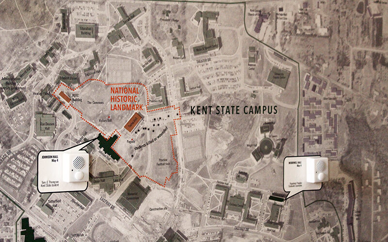
This project maps stories from the Kent State Shootings Oral Histories Project onto a map of Kent in 1970. The MappingMay4.kent.edu website provides an interactive …
Mapping May 4

Community Geography Collaboratory
A hub for community-driven maps & spatial data in Northeast Ohio
This project maps stories from the Kent State Shootings Oral Histories Project onto a map of Kent in 1970. The MappingMay4.kent.edu website provides an interactive …