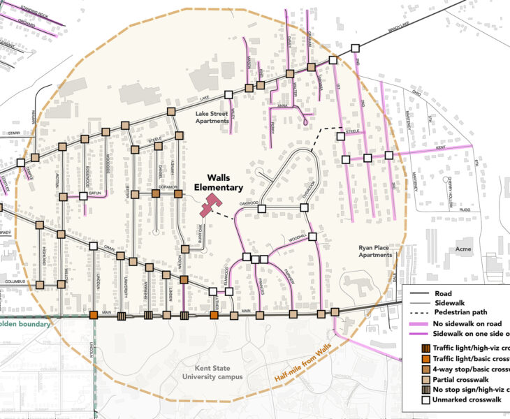
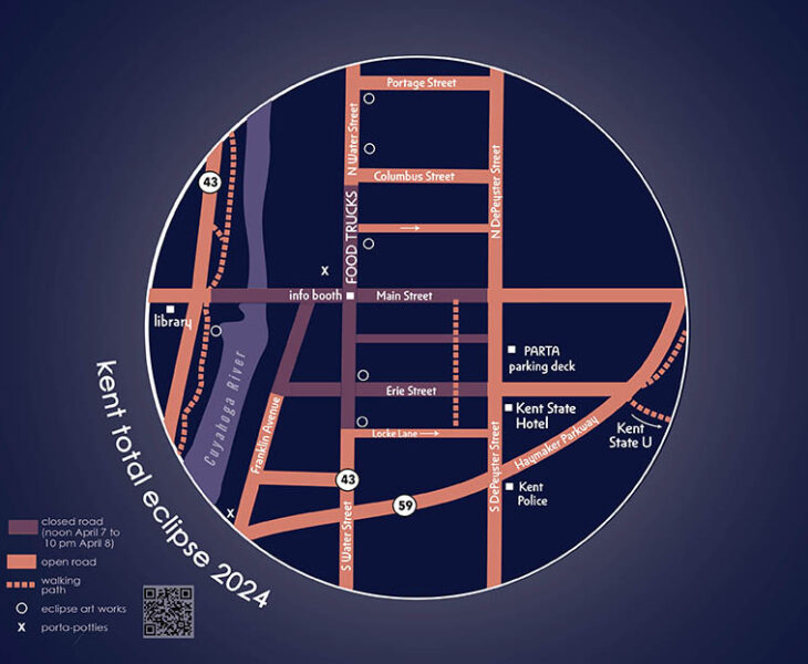
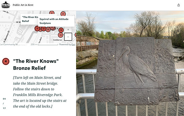
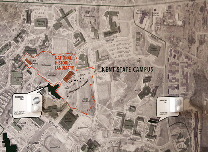
The Community Geography Lab is a physical and virtual space that encourages and facilities mapping for and by local community members. The space is a collaboratory: a research environment that allows researchers from across disciplines, as well as community residents, to come together in a space to collaborate and share resources. Our goal is to facilitate knowledge transfer between academics and non-academics, students and faculty, town and gown. The digital space (still under construction) will provide accessible mapping resources – open-source software and up-to-date data files, with a focus on being the campus and community clearinghouse for spatial data. The physical space is focused on mapping through collaboration and education using maps and the mapping process. Housed in McGilvrey Hall’s Map Library, the space encourages engagement and discussion about shared social and environmental challenges at Kent State, the city of Kent and other communities in Northeast Ohio and beyond.
The Community Geography Lab is a Design Innovation Node, part of a series of makerspaces and resource laboratories located across Kent State University colleges and campuses. It is available to the entire community as a place to meet, workshop, study, and create maps.

Community Geography Collaboratory
A hub for community-driven maps & spatial data in Northeast Ohio