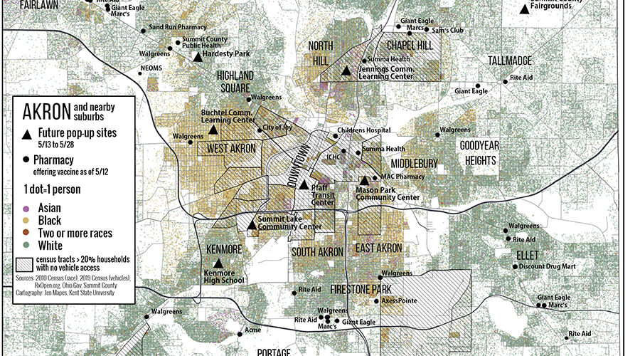
Published in May 2021, this map illustrates the relationship between pharmacies offering the COVID vaccine, population density, and race in Akron and its suburbs. It …
Vaccination availability in Akron

Community Geography Collaboratory
A hub for community-driven maps & spatial data in Northeast Ohio
Published in May 2021, this map illustrates the relationship between pharmacies offering the COVID vaccine, population density, and race in Akron and its suburbs. It …
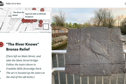
As a MapIt! graduate assistant, Josie Myers created several StoryMap walking tours for Main Street Kent, including the History of Industry and Public Art walking …
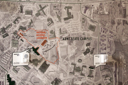
This project maps stories from the Kent State Shootings Oral Histories Project onto a map of Kent in 1970. The MappingMay4.kent.edu website provides an interactive …
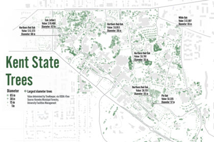
This map uses USDA i-Tree software to show the location, diameter and value of trees on the Kent State campus.Tree data available here.