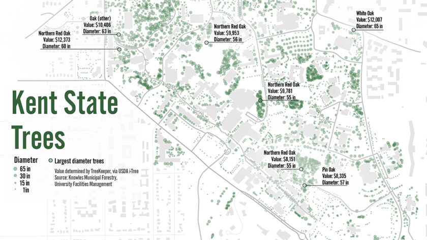
This map uses USDA i-Tree software to show the location, diameter and value of trees on the Kent State campus.
Tree data available here.


Community Geography Collaboratory
A hub for community-driven maps & spatial data in Northeast Ohio
This map uses USDA i-Tree software to show the location, diameter and value of trees on the Kent State campus.
Tree data available here.