Winner of the J.B. Jackson Prize About the bookThe New American Small Town is a book that started as my dissertation, an attempt to understand …
The New American Small Town: Lessons for sustainable futures

Community Geography Collaboratory
A hub for community-driven maps & spatial data in Northeast Ohio
Winner of the J.B. Jackson Prize About the bookThe New American Small Town is a book that started as my dissertation, an attempt to understand …
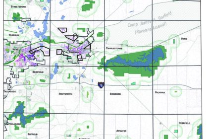
This map was created at the request of and in collaboration with the League of Women Voters Kent to localize the concept of park equity. …
This project was an expansion of research conducted by my Seminar in Geography class in 2022. In 2023, along with Dr. Lauren Kinsman-Costello and geography …

Community Geography includes campus research and education activities. In April 2023, we worked with folks from across campus to host the Bioblitz. Here’s what we …

During the early months of COVID, when daycare was closed, we walked our kid around the block twice a day. This is what we saw. …
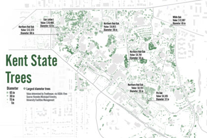
This map uses USDA i-Tree software to show the location, diameter and value of trees on the Kent State campus.Tree data available here.