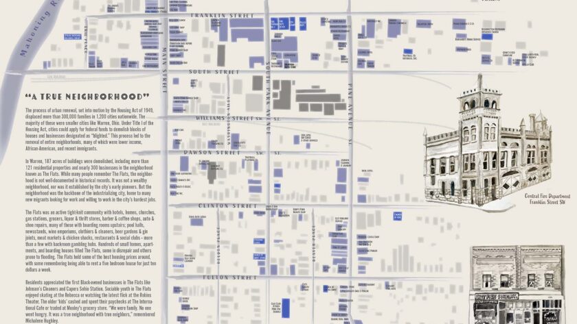

The Spring 2024 Seminar in Geography class worked with the Trumbull County Historical Society to map 300+ businesses that were lost to urban renewal in the 1960s and ’70s. Learn more about the history of The Flats neighborhood through this StoryMap.
The summer following the class, I worked to create a map poster illustrating the businesses we found were demolished as part of urban renewal in Warren, including watercolor illustrations of the buildings. Black and white photographs of the buildings just before demolition were included in the city’s urban renewal files, but with the illustrations I hoped to show them in at a more vibrant time in their lives.
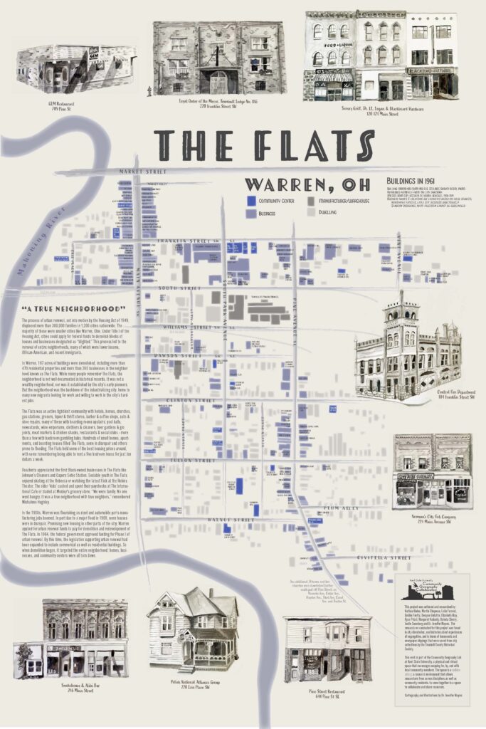
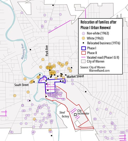
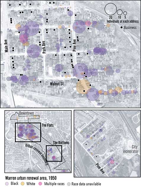
Over the past year, I’ve dug deeper into the history of Warren, including looking at who lived in each household in 1950 and a closer look at individual businesses — both showed an integrated neighborhood, one that was eliminated by urban renewal.