Skip to Content
Community Geography Collaboratory

Community Geography Collaboratory

A hub for community-driven maps & spatial data in Northeast Ohio

  • Home
  • Data: Environmental
  • Data: Social
  • Data: Economic
  • Data by Location
  • Visit us in McGilvrey Hall
Home Maps Environment Park Access in Portage County
Updated on 2026-01-022026-01-02Environment Maps People & Culture

Park Access in Portage County

Jennifer Mapes

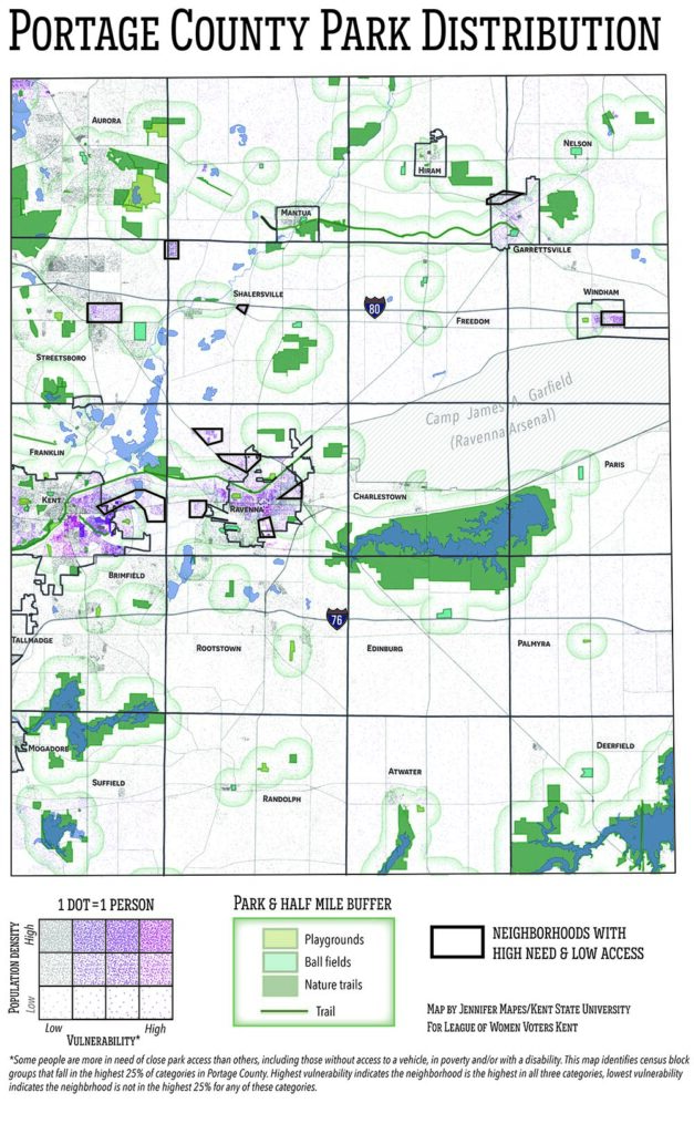
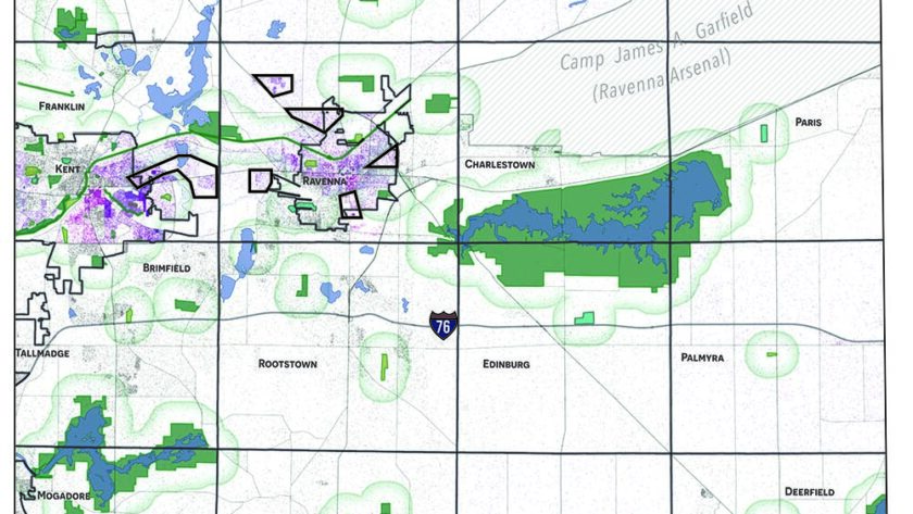
This map was created at the request of and in collaboration with the League of Women Voters Kent to localize the concept of park equity. We worked together to establish what characteristics should be mapped, what counted as a “park,” and to field-check the availability of amenities in each park. The final map informed the League’s position on parks and recreation in Kent and Portage County.

Previous Article The History of Kent State's Wetlands
Next Article The New American Small Town: Lessons for sustainable futures

Recommended Articles

Updated on 2025-12-152023-08-17Environment Maps People & Culture

Around the Block: A walk-a-day COVID map

Updated on 2026-02-222022-01-11Maps People & Culture

Mapping May 4

Updated on 2025-12-152023-08-17Environment Maps

Bioblitz observations

Data for Northeast Ohio

  • Data by Location
  • Data: Economic
  • Data: Environmental
  • Data: Social

Map news

  • The New American Small Town: Lessons for sustainable futures
  • Park Access in Portage County
  • The History of Kent State’s Wetlands
  • Mapping local elections
  • Who lived here? Mapping Kent’s South End
© Copyright 2026 Community Geography Collaboratory. All Rights Reserved. Yummy Recipe | Developed By Blossom Themes. Powered by WordPress.
×

Log In

Forgot Password?

Not registered yet? Create an Account